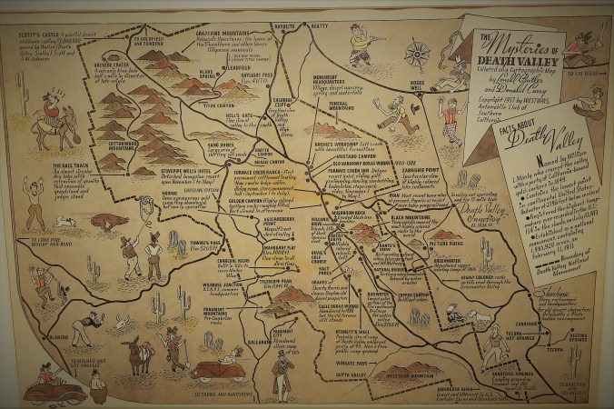
Death Valley Pictoral Map, from December 1937 Westways
In a post about Leadfield, there are written directions about the one way road, but maybe you are more of a visual learner. The above map shows the entrance to Titus Canyon Road at the top center, directly below Rhyolite (more to come about Rhyolite, but this should get you started).
Other helpful hints, courtesy of Campfire Tales:
- The story behind Leadville
- Don’t fall down any mineshafts
- Take plenty of water everywhere in Death Valley


Here to help!
